contents: welcome | using this page | five places not to miss | archaeological sites | churches, chapels and churchyards | events | military sites | mills | museums | schools and halls | standing stones | viewpoints | walks
This page is currently in development
Welcome
Intro
To set the scene for your visit we have included a brief overview of the last 13,000 years of life on the island [see: A (very) brief history of Burray and South Ronaldsay].
Using this page
We have only given brief details about the various destinations, and have, thus, tried to include where you can find out more.
All the places mentioned here can be seen on the Open Street Map and you can click straight to them from this page.
For detailed directions to the places discussed here just right-click on your chosen destination on the map, then ‘directions to here’ and enter where you are. You can choose your mode of travel – car, bike or foot. If any are missing from the map please let us know and we will add them.
Five places not to miss in South Ronaldsay
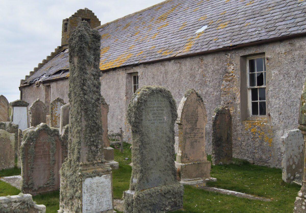
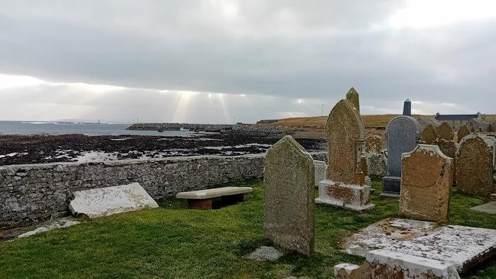
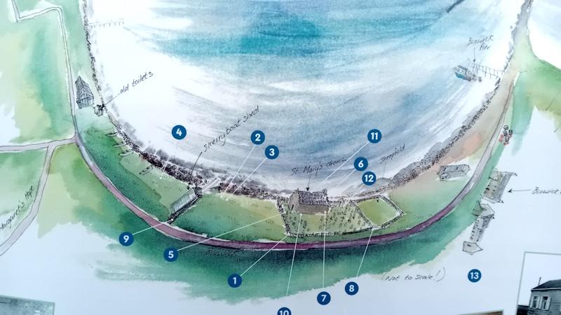
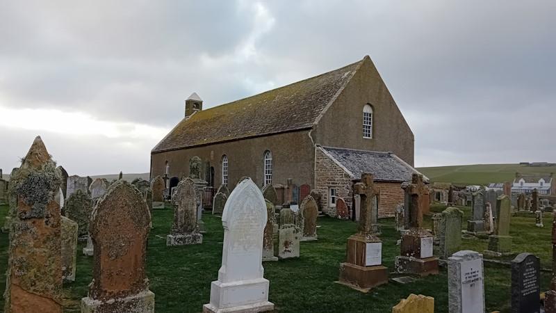
1. Old St Mary’s Kirk, Burwick and the south
Old St Mary’s Church aka Lady Kirk in Burwick is one of the most interesting places to visit in South Ronaldsay. It is said to be where the first Christian missionaries landed; home to the Ladykirk Stone; and has a fascinating short circular walk that takes in 13 different listening points that come alive on your mobile phone. The site of St Colm’s Chapel is a few metres east.
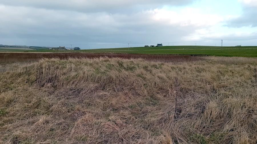
You can also add the Brough Ness circuit walk (a coastal path followed by a return along a quiet road – about 3.5 miles) or a visit to the site of the Castle of Burwick. Another option is to visit Liddle Burnt Mound (close to Isbister) and Tomb of the Eagles (if open).
2. Kirkhouse – St Peter’s, the standing stones, and the beach and sea
If you arrive in a car or on a bike, park in the car park at the bottom of the hill by the church.
Visit St Peter’s Church and graveyard.
Then go through the gate to see Kirkhouse Point and the ruins of the fishing station and windmill, and walk on a short way to the Millenium Standing Stone. You can walk on and enjoy the view or turnaround.
Walk back to the car park and then a short distance up the road to your right. The Sorquoy Standing Stone is on your right.
Alternatively (or as well) walk south from the car park. Enjoy the beach and sea at the Pool of Cletts and carry on to Newark Bay.
3. Hoxa Head and the Sands of Wright
Visit the Sands of Wright and the site of Sant Colme in Hoxay (St Colms Chapel, Sands of Wright). The Sands are home to The Festival of the Horse and Ploughing Match: one of Orkney’s unique occasions that dates back two centuries (see events). You can walk to one end and then back to the other or whatever takes you fancy.
Sant Colm was, essentially, where the mound is on your right as you look to the sea.
Turn right from the Sands of Wright car park, carry along the road for a short distance and take the first turn on your right. The road turns sharply to the left – but you need to go slowly down the track to the right and park before the building on your left. Do not enter the adjacent fields as they have horses in them. There is a pathway on the left that leads up to the Little Howe of Hoxa. [how to get to the Howe of Hoxa]
Take a walk around Hoxa Head and enjoy the view across Scapa Flow. Visit the wartime watch towers and…
and the sites of St Margaret’s Chapel
4. St Margarets’s Hope
St Margaret’s Hope, Front Road and the listening tour
5. Windwich, Cairns and Olav’s Wood
Walk through Olav’s wood
In Windwick visit the site of the dig at the Cairns (broch and settlement); and the memorial to sailors lost at sea (and site of St Andrew’s Chapel).
Take in the wonderful views from Ward Hill and/or Olad’s Summit.
Archaeological sites
You can view an Ordnance Survey map which shows the position of excavations in Burray and South Ronaldsay on the Megalithic Portal – click here.
Each site listed here includes links to The Megalithic Portal and Canmore. Click and you see what to look out for etc.
The Cairns, Windwick Bay. A fascinating site that has been featured on Digging for Britain [series 12, programme 3]. Details of the site can be found on Canmore and The Megalithic Portal. It is featured here in Places to Visit 5.
Broch or
A six-week season at The Cairns Iron Age site in South Ronaldsay will get under way on Monday, June 9, 2025, running until Friday, July 18. There will be at least one dig open day, currently scheduled for Friday, July 4.
Harra Brough, Broch or Nuraghe There is some doubt about whether this is a Broch as the site is inaccessible and the approach is said to be difficult and dangerous. However, viewed from the clifftop the site is fascinating. The Megalithic Portal describes it as follows: ‘A rather mysterious site… located on an extraordinary coastal outcrop named The Altar on the OS map [see, also, Canmore]
Howe of Hoxa, [See The Megalithic Portal and Canmore]
Little Howe of Hoxa,[See The Megalithic Portal and Canmore]
Tomb of the Eagles:
Tomb of the Otters aka Banks Chambered Tomb
The Wart, Chambered
Churches and churchyards
There are a significant number of old chapels and churches dotted about the islands. Some are in ruins, others converted to housing and various other uses, and several are just memories. From around 1440, the three main churches on the two islands were linked. St. Peter’s church in the north of St Ronaldsay was united to the church of Our Lady (St Mary’s in the south) and to St Lawrence (aka St. Laurence) in Burray.
South Ronaldsay was divided by the established church into two unequally sized parishes for much of the twentieth century. St Mary’s in the south was about half the size of St Peter’s in the north. South Ronaldsay also had several smaller chapels (nine in 1647) and later a couple of mission halls and a free church.
Old St Mary’s Church aka Lady Kirk in Burwick, South Ronaldsay (KW17 2RN, click for map). The kirk was probably established at this spot in the 11th century, however, the first record of it on a map dates from 1654. Before the opening of the Lady Kirk, there was a chapel (St Colm’s) a few hundred metres to the east dating from the ninth century or earlier (see below).
Today, the church is no longer used as a parish church. That role is played by St Margaret’s Kirk in St Margaret’s Hope (see below). However, the building has been adopted by a group of local people who recognized its continuing significance historically and as a resource for the community. Here it is worth mentioning five elements that make it one of the most interesting places to visit in Orkney (and it is free!). When open/how to gain access
First, Burwick’s coast is said to be where the earliest Christian missionaries landed in the Isles. Adomnan, the ninth abbot of Iona and the writer of Life of Columba (Vita Columbae) reports that Cormac Ua Liatháin arrived in around 580 AD. He had probably sailed around the mainland from Iona where St Columba’s monastery was based. It is said that Columba had met with King Brude – the Pictish chief ruler of the Orkney Islands – and asked that Cormac and others be protected. Cormac was later made an Irish Saint.
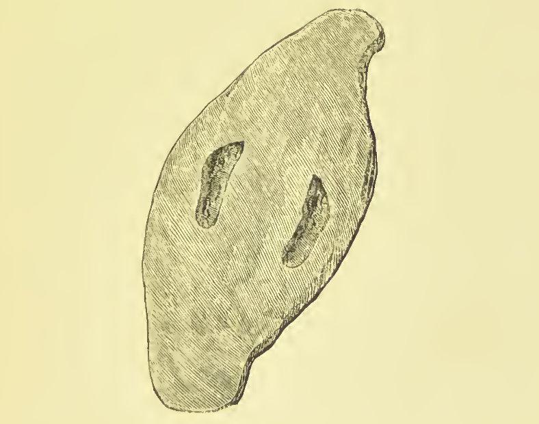
Second, Old St Mary’s is home to Ladykirk Stone. This is a rounded grey whin stone carved with two footprints. It was for many years outside the church but is now kept inside. There is some suggestion that it might be a Pictish coronation stone, however, there are various other stories associated with it. At one point it was called St.Magnus Boat (see The Megalithic Portal for more information). This is how George Low (1879) described it:
In Lady Kirk at Burwick saw a large stone which tra-
dition says St. Magnus used as a boat to feiry him over the Pightland Firth, and for its service laid it up in this Church, where it is still preserved. Its shape is boat-like, but that it ever served that purpose is of the complexion of many-other Monkish stoiies which in times past were greedily swallowed by the unthinking vulgar. This stone is about 4 feet long, and 2 broad, about 8 inches thick, seems to have been taken from the next sea beach where many such are still to be found ; has engraved on it the prints of a man’s feet, which probably furnished the first hint for the miraculous use of it, and may point out the true one, which there is little doubt but it was a stone appropriated to expose delinquents at the Church in times of Popery.
George Low (1879) A Tour through the Islands of Orkney and Shetland
Third, like nearly all churches and chapels in South Ronaldsay, it is situated next to the sea – but unique in that it faces the Pentland Firth. As a result, visitors look across to John O’Groats and mainland Scotland, and at the Firth itself. Known for the strength of its tidal currents, which are among the fastest in the world, it also has a range of marine wildlife on view. Its name is said to be a development of the Old Norse ‘Petlandsfjörð’ which can be translated as ‘the fjord of Pictland’.
Fourth, it offers a fascinating short circular walk that takes in 13 different listening points that come alive on your mobile phone. Subjects include the Ladystone, creels, coastguard, sheep, smallpox, the Sunday School, and the Island of Swona – that can be seen across the Firth.
Fifth, Old St Mary’s will become the home of a large and fascinating tapestry/quilt that shows all the fields (and their local names) in the bottom half of South Ronaldsay. Currently, the tapestry is being worked on by local islanders (The Field Quilt Group) – and will hang in the church once it is completed.
Sant Colmis / St Colm’s Chapel, at Loch of Burwick, South Ronaldsay (KW17 2RN, click for map). There were a couple of other St Colm’s chapels in South Ronaldsay (in Hoxa and Grimness). The popularity of the name derives from the fact that it is a Gaelic variation on Columba. The work of St Columba (c. 521-597) and his disciples was central to the conversion to Christianity of many living in Scotland during the sixth century. Columba was the Latin name for dove – and his Irish name Colm Cille, means ‘dove of the church’. There was a loch beyond the chapel which has now been drained.
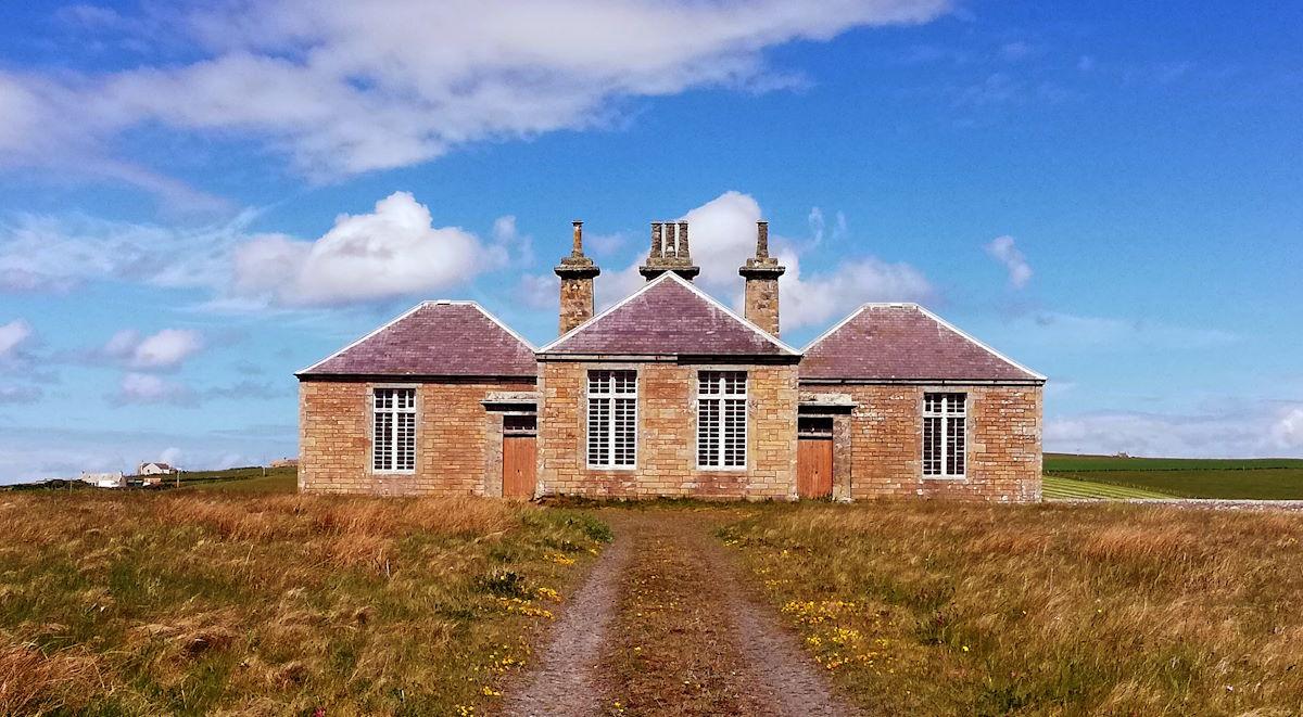
St Peter’s Church and Hall, Kirkhouse Road, South Ronaldsay (KW17 2TJ, click for map). The church is open to view from 11 am to 3 pm (Thursday to Sunday over the summer??)
Like St Mary’s no longer used as a parish church.
constructed in the 17th Century, renovated in 1801 and again in 1967. classic windows face the sea
First, fascinating inside
Second The discovery of a Pictish symbol stone, slightly trimmed and re-used in a window, suggests that this church site has a long history
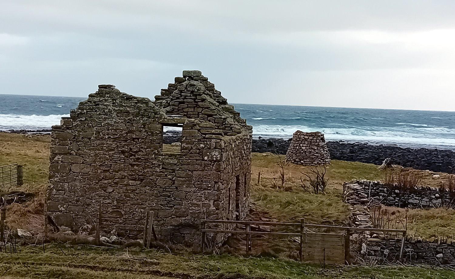
Third, great walk along the beach to the south, next door old fishing station, windmill)
North Sea – waves etc.
(add in the Manse and Manse Bay,
Sant Margrat in the Howp – St Margaret’s Chapel, School Road, St Margaret’s Hope, South Ronaldsay (KW17 2TN – click for map).
St Margaret’s Kirk (Church of Scotland), built in 1856 and enlarged in 1870. see: https://www.scotlandschurchestrust.org.uk/church/st-margarets-south-ronaldsay/ – Opened 1856 by the United Presbyterian Church and enlarged 1870. Its central location in the village of St Margaret’s Hope led to it being designated as the principal place of worship for the Parish of South Ronaldsay & Burray. Communion table and font from former St Lawrence’s Church, Burray.
Recent total internal refurbishment provides the congregation and community with excellent facilities.
In addition to Sant Colmis at the Loch of Burwick (St Colm’s Chapel) and Sant Margrat in the Howp (St Margaret’s Chapel) seven other chapels were recorded on the island in 1627. They were:
- Sant Androis at Woundwick (Saint Andrew’s, Windwick),
- Our Ladie at Halcro (Our Lady’s Chapel and burial ground, Halcro),
- Ruid chappell in Sandwick (Ruid Chapel and Burial Ground, Mucklehouse) C14,
- Sant Tola [Olaf] in Wydwall,
- Sant Colme in Hoxay (St Colms Chapel, Sands of Wright),
- Sant Colmeis in Grymnes (St Colm’s Chapel, Grimness), and
- Sant Ninian in Stow. (Site of Saint Ninian’s Chapel Stews – click for map)
Manse opposite Lythe
____
St Ola’s Chapel and Burial Ground, Kirkhouse
Free Church and Manse by Tomison’s Academy
Gospel Hall, St Margaret’s Hope
Mission Hall, Herston
St Colm’s Chapel, Grimness (click for map)
St Margaret’s Chapel, School Road
Events
The Festival of the Horse and Ploughing Match: one of Orkney’s unique occasions that dates back two centuries – https://calendarcustoms.com/articles/boys-ploughing-match-festival-of-the-horse/ and http://www.orkneyjar.com/tradition/festivalofhorse.htm.

Sooth Isles Craft Fairs, Cromarty Hall: local craft people exhibiting their work – https://www.facebook.com/South-Isles-Craft-Fairs-240242836455908/.
Military sites
Mills – water and wind
https://en.wikipedia.org/wiki/List_of_watermills_in_the_United_Kingdom
Museums
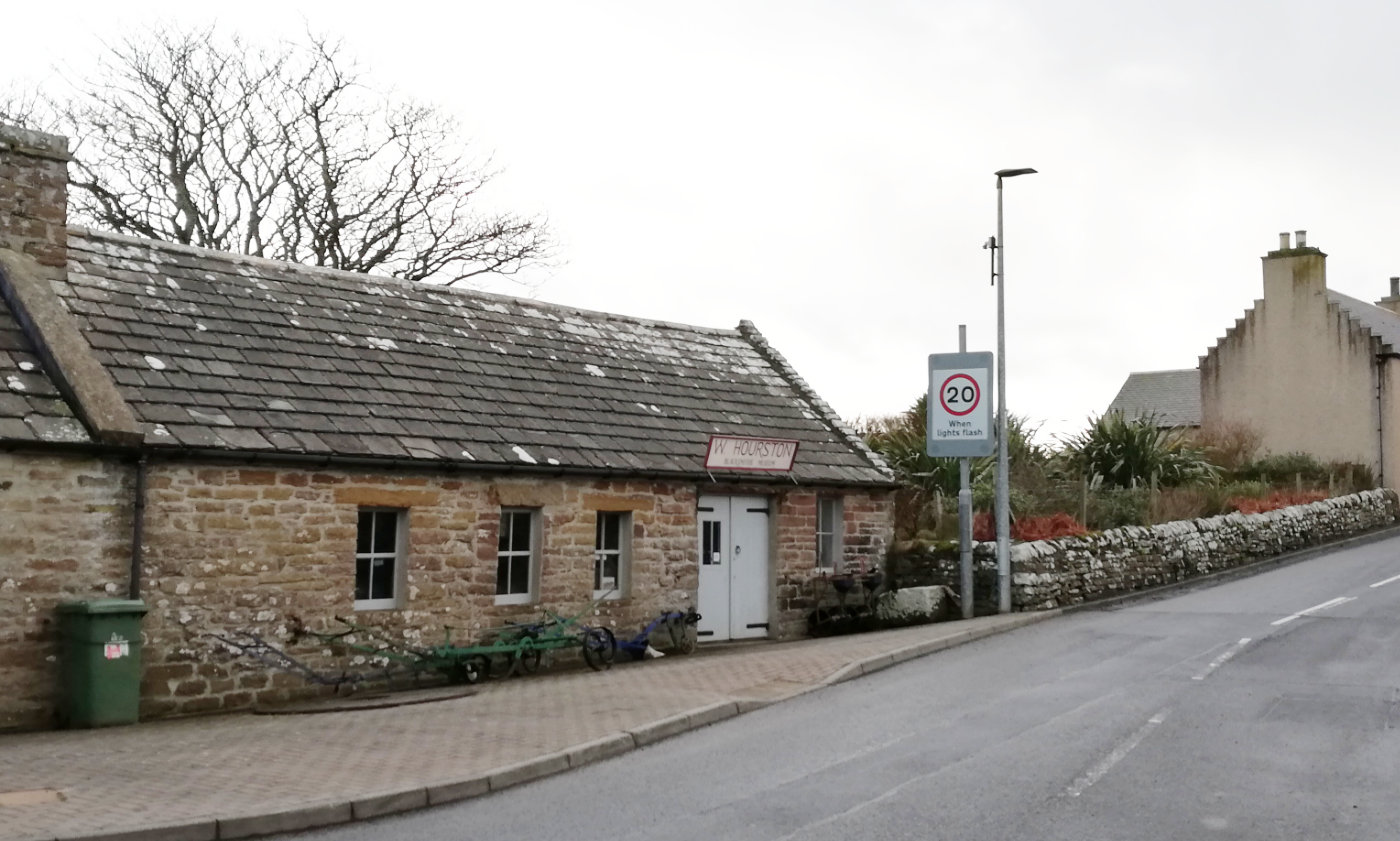 Smiddy Museum, School Road, St Margaret’s Hope, South Ronaldsay: open in the summer season, the Smiddy Museum is a restored blacksmith’s Smiddy. It contains equipment and machinery ranging over the past century, along with a collection of horse-drawn implements and other smiddy-made artefacts. It also houses photographic archives of local village and island life – https://en-gb.facebook.com/smiddymuseum/.
Schools and halls
Herston primary
Tomison’s Academy
Widewall
Standing stones
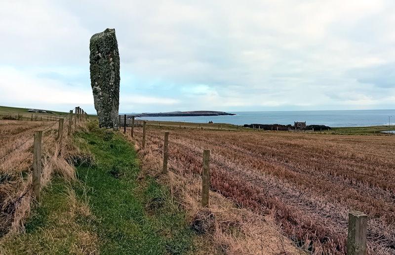
Sorquoy Standing Stone, Kirkhouse Road, South Ronaldsay (KW17 2TJ click for map). This is one of the larger standing stones in Orkney. It is over 14ft high. Getting to it requires some care, for while the route is marked as a path, it is not easy to follow. The walk is uneven and competes with a ditch for much of its length.
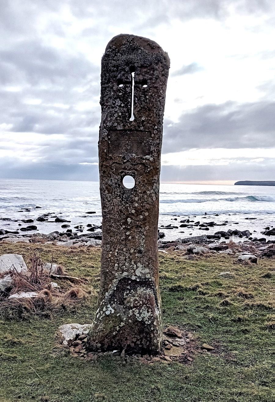
The Millenium Standing Stone, Kirkhouse Road, South Ronaldsay (KW17 2TJ, click for map). Created by a local craftsman – Willie Budge – this stone features various historical elements such as a dragon head, Pictish symbols, and a Viking longship. It also cleverly uses a hole that echoes that of The Stone of Odin at the Ness of Brodgar (click to read about the different interpretations of why the hole was created).
Eastside
Standing Stone (Menhir)
Oyce of Quindry in a tidal inlet
Viewpoints and features
Olad’s Summit
Olav’s Wood
Ward’s Hill
Walks
Visit Walkhighlands for details of five walks on Burray and South Ronaldsay
Brough Ness circuit, Burwick, South Ronaldsay. The walk takes around 2 hours and is listed as 5.75 km. [Walkhighlands]
East Coast walk, South Ronaldsay The walk takes around 5 hours and is listed as 14.5km. [Walkhighlands – this is not a circular walk. It ends around 3km from St Margaret’s Hope – and, at the moment there is no regular bus from the Hope back down to the starting point in Burwick. If there is someone who will drop you off at the start and pick you up at Kirkhouse then you are in luck. Another option is to do a shorter version and return e.g. Burwick to Windwick – or Kirkhouse to Windwick].
Hoxa Head, South Ronaldsay – The walk takes around an hour and is listed as 2.7km. [Walkhighlands – circular walk]
Sands o’ Wright, South Ronaldsay The walk takes around two hours (max) and is listed as 6km. [Walkhighlands – this is a circular walk).